Blog

Category: Prefecture F – J

Aomori Prefecture

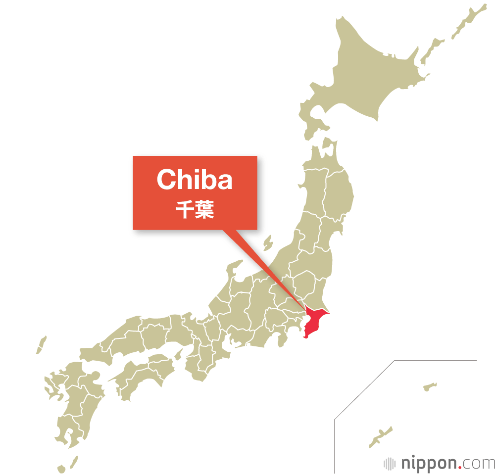
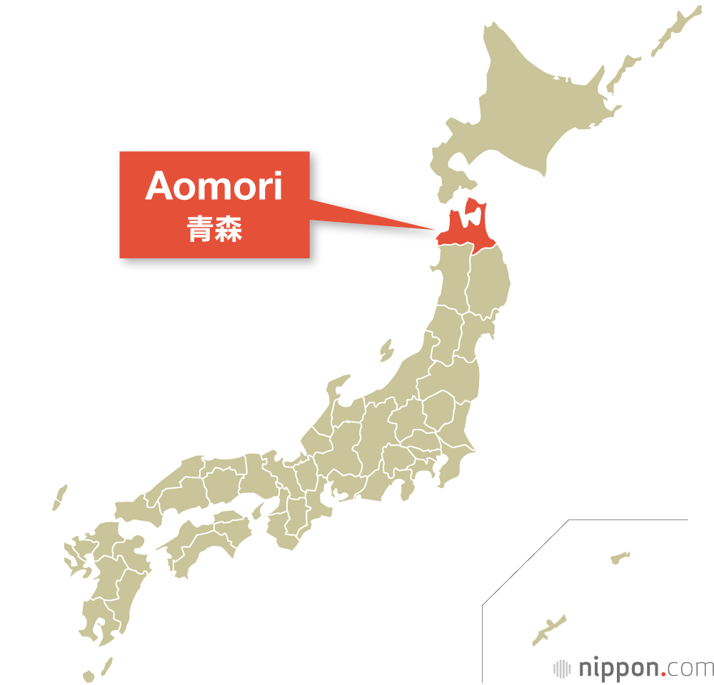
The Prefectures of Japan Aomori Prefecture

Aomori Prefecture Banzai Japan Idol Group Visit there Website Aomori Prefecture lies at the northern tip of Honshū, Japan’s largest island. Famed for its apples, its seafood, and its natural beauty, this remote part of the country is rich in wild landscapes to explore. Aomori Prefecture is the northernmost part of the Tōhoku region, located at the northern tip of Honshū. Its location ensures it cold winters with plenty of snow, but its coastlines on both the Sea of Japan and Pacific Ocean bring it plenty of climatic variety. Aomori’s apples are famed nationwide, and its fishing ports like Ōma are known for landing some of the most highly prized tuna on the Japanese market. Aomori Prefecture at a Glance Established in 1871 (formerly part of Mutsu province) Capital: Aomori Population: 1,238,000 (as of Oct. 2020) Area: 9,646 km2 Aomori’s largest city is the prefectural capital, also called Aomori, followed by Hachinohe and Hirosaki. Even the capital only has some 280,000 residents, though, and the prefecture as a whole is sparsely populated. Its two main peninsulas, the Tsugaru Peninsula to the west and the curved Shimokita Peninsula to the east, enclose Mutsu Bay. The southern portion of Aomori is mountainous, featuring peaks like the 1,625-meter Mount Iwaki that overlooks Hirosaki and the Hakkōda range, and the picturesque Lake Towada, on the border with Akita Prefecture in the south center of Aomori. Aomori’s distance from Tokyo long made it difficult to access for business and other travel, but the 2002 extension of the Tōhoku Shinkansen line to Hachinohe, and the 2010 extension as far as Shin-Aomori in the capital, made it possible to journey from Tokyo to the city of Aomori in as little as 3 hours, 10 minutes. In 2016, a further Shinkansen extension connected Shin-Aomori with Shin-Hakodate-Hokuto station in Hokkaidō, traveling under the Tsugaru Strait via the Seikan Tunnel, the world’s longest tunnel beneath the sea. Aomori’s main industries are farming, fishing, and forestry. On a calorie basis it is the fourth highest in the nation in terms of food self-sufficiency, producing 123% of its needs as of fiscal 2019. It leads Japan in the production of apples, garlic, and gobō, or burdock root. From the sea, Aomori’s fishing fleet haul in some of the country’s most prized tuna each year, particularly at the northern port of Ōma; Aomori ranks near the top in Japan for tuna, akaika (flying squid), scallops, and konbu seaweed, among other marine products. Aomori’s wild nature attracts considerable numbers of tourists, who come to admire sights like the Shirakami-Sanchi, a wilderness region featuring an old-growth beech forest inscribed as a UNESCO natural World Heritage site in 1993, and the Oirase Gorge. Hirosaki Park in the city of Hirosaki is a renowned cherry-blossom-viewing destination, and the prefecture’s volcanic activity ensures a steady stream of tourists enjoying hot springs like Furōfushi Onsen and Sukayu, as well as the fearsome landscapes of Osorezan, a “sacred spot” viewed as an ideal place to commune with the dead. In the city of Aomori, meanwhile, the annual Nebuta Matsuri is a major event on the festival calendar, attracting well over a million viewers in peak years. Famous Figures Dazai Osamu (1909–48): Writer. Born Tsushima Shūji, during his short and turbulent life he dabbled with communism in the prewar years while he honed his craft writing autobiographical novels and short stories. Following the war he reached the height of his career with celebrated works like Shayō (trans. The Setting Sun) and Ningen shikkaku (trans. No Longer Human). Drowned himself in west Tokyo along with a lover in 1948. Yano Akiko (1955–): Musician. Although born in Tokyo (as Suzuki Akiko), she grew up in Aomori before launching her music career with the 1976 album Japanese Girl. Went on to collaborate and tour with bands like Yellow Magic Orchestra, in addition to recording tracks and providing voice work for Studio Ghibli shorts and full-length films. https://www.youtube.com/watch?v=VfelvCnfmdQ

Read More 🡥
Iwate Prefecture

The Prefectures of Japan Iwate Prefecture

Iwate Prefecture Banzai Japan Idol Group Visit there Website The sparsely populated Tōhoku prefecture of Iwate is home to both rugged mountains inland and an extensive coastline on the Pacific Ocean. Rich in history, it is also the site of Hiraizumi, whose Buddhist temples earned it a World Heritage designation in 2011. Iwate Prefecture is in the Tōhoku region, located on the Pacific coast of Honshū. It is the second largest prefecture in Japan, behind only Hokkaidō, but a low population density leaves it with plenty of space for natural beauty. Ski resorts in the west of the prefecture and spectacular coastal views in the east draw visitors year-round. Iwate Prefecture at a Glance Established in 1871 (formerly part of Mutsu province) Capital: Morioka Population: 1,211,000 (as of Oct. 2020) Area: 15,275 km2 Iwate’s capital, Morioka, is the largest city in the prefecture, but is still home to fewer than 300,000 people. Much of the population is concentrated along the Kitakami River, Japan’s fifth longest, in the prefecture’s west, also the route taken by the Tōhoku Shinkansen line. The western border of the prefecture, shared with Akita, is mountainous and sees heavy snow in the winter. Ski resorts like Shizukuishi, Hachimantai, and Appi—all near the prefecture’s tallest peak, the 2,038-meter Mount Iwate—enchant winter sports fans with their long runs and lack of crowds. The Pacific coast was heavily hit by tsunami following the March 11, 2011, Great East Japan Earthquake, which made the names of cities like Miyako and Kamaishi known nationwide and even around the world. Cape Todo, on the prefecture’s central coast, is the easternmost point on the main island of Honshū. Despite its distance from the centers of Japanese culture in antiquity, Iwate was home to a major center of Buddhism in the north. Hiraizumi, a city designed according to Pure Land Buddhist principles in the eleventh and twelfth centuries, earned UNESCO World Heritage status in 2011 for its gardens, archaeological sites, and temples including Chūsonji and Mōtsūji. Iwate’s small population means it is no industrial powerhouse, but it ranks fifth in the nation in forestry, providing some 5% of the nation’s lumber based on value as of 2015. Its rugged ria coastline, characterized by narrow inlets separated by high ridges, makes it ideal for production of shellfish, particularly abalone, in which it leads Japan. By no means a major industry, but one prized by tea aficionados, is Nanbu tekki, cast iron pots made in and around Morioka for some four centuries. Iwate is a land of literature and folktales. The folklorist Yanagita Kunio in 1910 wrote Tōno monogatari (Tales of Tōno), a collection of stories collected in the central Iwate district of Tōno, establishing the modern foundations of Japanese folklore studies. The early twentieth century also saw the writing career of Miyazawa Kenji, whose stories of the Iwate-inspired land of Ihatov are loved to this day. The Wanko Kyōdai, siblings based on the popular Morioka dish wanko soba (endless tiny bowls of soba noodles brought in rapid succession to diners until they have had their fill), are Iwate Prefecture’s official mascots. Famous Figures Miyazawa Kenji (1896–1933): Writer. Plagued by illness for much of his life, during which he received little recognition, in death he became known for his works set in Ihatov, his fictional land based on Iwate. Best known for the poem “Ame ni mo makezu” (trans. “Undefeated by the Rain”) and novels like Ginga tetsudō no yoru (trans. Night on the Galactic Railroad). Nitobe Inazō (1862–1933): Educator. Studied agricultural policy in the United States before returning to Japan, where he taught at universities in Sapporo, Kyoto, and Tokyo and devoted himself to women’s education as the first president of Tokyo Women’s Christian University. Known also as the author of Bushidō: The Soul of Japan.   https://www.youtube.com/watch?v=j5gy6QLq8wg

Read More 🡥
Miyagi Prefecture

The Prefectures of Japan Miyagi Prefecture

Miyagi Prefecture Banzai Japan Idol Group Visit there Website Miyagi Prefecture has long been known for its magnificent coastline, and is the most populous prefecture in the Tōhoku region of northern Honshū. Miyagi Prefecture lies on the Pacific coast of Honshū in the northern Tōhoku region. Rich in wild beauty, with almost a quarter of its territory falling inside of natural parks, it is famed for its coastline, in particular the hundreds of rocky islands of Matsushima, considered to be one of the three most spectacular scenic views in Japan. Miyagi Prefecture at a Glance Established in 1872 (formerly part of Mutsu province) Capital: Sendai Population: 2,302,000 (as of Oct. 2020) Area: 7,282 km2 Miyagi’s capital is Sendai, the largest city in the Tōhoku district, with more than a million people calling it home. The prefecture’s location on the eastern side of the island of Honshū means that the high mountains along its western border with Yamagata Prefecture protect it from the worst of the winter storms blowing in from Siberia, and it enjoys relatively warm winters compared to neighboring areas in Japan’s north. Miyagi borders Iwate and Akita to the north, Yamagata to the west, and Fukushima to the south. The west of the prefecture is mountainous, lying along the long Ōu range extending from Aomori in the north to Tochigi in the south. The bulk of the prefecture’s center is relatively flat, making it ideal for agriculture. Miyagi ranks first in the nation in production of seri (Japanese parsley) and bell peppers, and second in soybeans and Malabar spinach. The northern Miyagi coast, including the Oshika Peninsula, presents rugged terrain characterized by numerous ria inlets. This was the area closest to the epicenter of the March 11, 2011, Great East Japan Earthquake, and many coastal communities like Kesennuma and Ishinomaki saw severe damage and high numbers of casualties in the disaster. The prefecture’s rich seas place Miyagi near the nation’s top in its production of nori and wakame seaweed, oysters and scallops, and farmed Coho salmon. Miyagi’s shoreline is famed for its beauty, with the hundreds of islets of Matsushima being counted among Japan’s three most scenic spots. This area has been celebrated for centuries, as seen by the poet Matsuo Bashō’s visit to it in 1689, when he described it as the finest scenery in the country. Electronics and other manufacturing industries cluster around the capital and largest city of Sendai, forming another mainstay of the prefectural economy. Figuring large in the history of Miyagi was the renowned military tactician Date Masamune (1567–1636), who built Aoba Castle in Sendai and served as the first daimyō of the Sendai domain. During the Edo period (1603–1868) Sendai was the administrative center of the Mutsu province, extending north to include present-day Iwate and Aomori. Musubimaru, the tourism PR character of Sendai, Miyagi, has a face calling to mind a ball of Miyagi’s delicious rice, and wears a helmet called a katchū like that worn by Date Masamune. Famous Figures Yoshino Sakuzō (1878–1933): Political scientist. In the 1910s, he spent several years doing research in Europe and the United States; upon his return to Japan, he began exploring ways to implement democratic principles in his country, refining the minpon-shugi theory that placed people at the center of democracy without doing away with the imperial institution. Known as a father of the Taishō democracy that flowered during the interwar years. Fukuhara Ai (1988–): Table tennis player. Competed at the 2004 Athens Olympics, becoming the youngest-ever table tennis athlete to take part in the games. She would also compete in Beijing (2008), where she was the national team’s flag-bearer, London (2012), and Rio de Janeiro (2016). Hanyū Yuzuru (1994–): Figure skater. Won two Olympic gold medals in the men’s singles competition, in Sochi in 2014 and Pyeongchang in 2018. Turned professional in 2022 and remains one of the most popular athletes in any sport in Japan. https://youtu.be/60JaJn1zabE?si=IqlFu7HfijX6DpzH

Read More 🡥
Akita Prefecture

The Prefectures of Japan Akita Prefecture

Akita Prefecture https://youtu.be/m3F_DvV7PsM?si=XXILNDgJxOE79W7Y The remote Akita Prefecture, in the northern Tōhoku region of the main island of Honshū, is known for its cold, snowy winters and as the birthplace of beautiful women. Akita Prefecture, on the Sea of Japan coast in the Tōhoku region, is the sixth largest prefecture by area, but thirty-eighth by population. Its rugged mountains, harsh winter weather, and distance from the country’s population centers make it a place to go to get away from it all; more than 10% of the prefecture’s land falls inside of natural parks. Akita Prefecture at a Glance Established in 1871 (formerly parts of Dewa and Mutsu provinces) Capital: Akita Population: 960,000 (as of Oct. 2020) Area: 11,638 km2 Banzai Japan Idol Group Visit there Website The city of Akita, the prefectural capital, is the largest in the prefecture, with more than 300,000 residents. Siberian storms in winter bring it heavy snowfall, like much of the Japan Sea coastal regions of Honshū and Hokkaidō—the city is often included on top-10 lists of the world’s major cities with the most annual snowfall. The coastline is largely straight and smooth, with the exception of the Oga Peninsula in the northwest of the prefecture; in the center and east lie the Dewa and Ōu mountain ranges. Akita borders Aomori to the north, Iwate to the west, and Miyagi and Yamagata to the south. In 1997 the Akita Shinkansen was completed, connecting the capital to Morioka, Iwate, and south to Tokyo on the Tōhoku Shinkansen route. Akita’s natural resources long made it a regional economy dependent largely on agriculture, forestry, and fishing. Since World War II, however, the prefecture has come to produce a range of industrial products, such as radio receivers and camera lenses, in which it led the nation as recently as 2008. One particularly adorable natural resource from the prefecture is the Akita-inu, a breed of dog selected as a national natural monument. The most famous of these was the faithful Hachikō, whose statue is a popular meeting point outside Tokyo’s Shibuya Station. Akita is still known as a major rice producer. One of its most famous contributions to Japanese cuisine, kiritanpo, is pounded rice molded around wooden skewers and toasted over an open flame before being eaten with miso paste or as a main nabe hot-pot ingredient. The namahage, frightfully costumed ogres who barge into homes on the Oga Peninsula each New Year’s Eve and ask whether the children are behaving properly, are a famous aspect of Akita’s local culture. In the summer, a major tourist draw is the Ōmagari National Fireworks Competition, which brings together the nation’s top pyrotechnicians to show their best work to hundreds of thousands of observers. Akita is also known as the birthplace of Ono no Komachi, a ninth century poetess celebrated as one of the Rokkasen, or “poetic immortals,” and for her beauty, said to be such that to this day her name is a synonym for feminine beauty. Her name has also been given to the Komachi train service connecting Akita with Tokyo on the Shinkansen network. Ndatchi, the prefectural mascot, is a robot in the form of a namahage child who has come from the future to spread the word about Akita’s charms. Famous Figures Suga Yoshihide (1948–): Politician. Served as chief cabinet secretary to Prime Minister Abe Shinzō from 2012 to 2020 before taking the premiership himself from 2020 to 2021. Akashi Yasushi (1931–): Diplomat. After graduating from the University of Tokyo, went to the United States as a Fulbright Scholar and later a graduate student at the Tufts University Fletcher School of Law and Diplomacy. In 1957 he became the first Japanese national to go to work for the United Nations Secretariat; he would go on to serve in a number of key roles, rising to the position of under-secretary-general. He also served as Japan’s ambassador to the United Nations.   https://www.youtube.com/watch?v=NOzd7vFfP0k

Read More 🡥
Yamagata Prefecture

The Prefectures of Japan Yamagata Prefecture

Yamagata Prefecture Prefecture Banzai Japan Idol Group Visit there Website Snowy Yamagata Prefecture, in Japan’s Tōhoku region, is home to the Dewa Sanzan, three sacred mountains forming the core of one of the oldest religious traditions in the country. Yamagata Prefecture, on the Sea of Japan coast in the Tōhoku region, lies south of Akita, west of Miyagi, and north of Niigata and Fukushima. The ninth largest prefecture by area but just the thirty-fifth by population, it is a sparsely populated place featuring rugged mountains including the Dewa Sanzan, three peaks held to be sacred spots for practitioners of Shugendō, one of Japan’s oldest native religious traditions. Yamagata Prefecture at a Glance Established in 1876 (formerly part of Dewa province) Capital: Yamagata Population: 1,068,000 (as of Oct. 2020) Area: 9,323 km2 The inland city of Yamagata, the largest in the prefecture, has just short of 250,000 residents calling it home. Tsuruoka and Sakata, on the northern coast, and Yonezawa in the south follow the capital in the population rankings, but Yamagata Prefecture as a whole is largely rural. Fully 17% of the prefectural area falls inside of natural parks, and the eastern border of Yamagata runs along the Ōu Mountains, the longest range in Japan. In the far north of the prefecture is Mount Chōkai, its highest point at 2,236 meters in elevation. The prefectural center, meanwhile, is the site of the northern Echigo Mountains, including Mount Gassan (1,984 meters), Mount Yudono (1,504 meters), and Mount Haguro (414 meters). These are the Dewa Sanzan, the “three peaks of Dewa” where Shugendō retains a strong hold. These mountains are also cherished by the relatively newer arrival of Buddhism; the Yamadera (“mountain temple”) complex of several dozen structures, formally named Hōjusan Risshakuji, was founded in 860 by Jikaku Daishi (794–864), then the head of Japan’s Tendai school of Buddhism. An esoteric sect of the faith also produced the tradition of sokushinbutsu, in which monks committed themselves to mummification while still alive, seen most frequently in the temples of Yamagata. The prefecture’s economy depends heavily on modern industries like communications and electronics devices and chemical products, building on a mining tradition that led also to a strong metal-casting industry from medieval times onward. Yamagata remains known for its agriculture as well, though, in particular cherries (the prefecture grows around 70% of the national total) and Yonezawa wagyū beef, one of the top local appellations in Japan. The area became much more accessible from Japan’s main population centers in 1992, when the Yamagata Shinkansen was opened as far as the prefectural capital; in 1999 the line was extended as far as Shinjō in Yamagata’s north. This spur line parts from the main Tōhoku Shinkansen route at Fukushima Station to bring passengers across the spine of Honshū to the island’s west. Kitekero-kun, the Yamagata prefectural mascot, has a name that means “Please come on up!” in the local dialect of Japanese. Kitekero-kun has a face shaped like Yamagata and wears a hat decorated with the prefecture’s famed cherries. Famous Figures Ogata Taketora (1888–1956): Journalist and politician. Was the chief editor of the Tokyo Asahi Shimbun in the prewar and early wartime era, as well as vice president of the newspaper publisher; turned to politics thereafter, serving in the cabinets of Koiso Kuniaki (1944–45) and Higashikuni Naruhiko (1945). Was purged from politics under the Allied Occupation but returned to serve in the cabinet of Prime Minister Yoshida Shigeru in 1952–53. Inoue Hisashi (1934–2010): Writer. Established his fame as a playwright, launching his own theater troupe, the Komatsuza, in 1983, but was also an accomplished novelist, winning the Naoki Prize in 1972 for Tegusari shinjū(Handcuffed Double Suicide) and both the Yomiuri Prize for Literature and the Japan Science Fiction Grand Prize in 1981 for Kirikiri-jin (The People of Kirikiri). Katō Kōichi (1939–2016): Politician. Born in Aichi, Katō grew up in Yamagata and represented the prefecture in the Diet for most of the period from 1972 to 2012. In 2000, following the death of Prime Minister Obuchi Keizō, launched “Katō’s rebellion” against the caretaker prime minister, Mori Yoshirō, but was driven from the political sphere for a time after its failure. https://www.youtube.com/watch?v=dYxK4SPZKOE

Read More 🡥
Ibaraki Prefecture

The Prefectures of Japan Ibaraki Prefecture

Ibaraki Prefecture Banzai Japan Idol Group Visit there Website Ibaraki Prefecture, north of Chiba on the Pacific coast in the Kantō region, is known as home to the famed garden Kairakuen, the site of Japan’s second-largest lake and second-longest river, and the nattō capital of Japan. Ibaraki Prefecture, located in the Kantō region to the north of Saitama and Chiba Prefectures, is famed for its association with nattō, which some claim was first created here a thousand years ago. There is more to the prefecture than fermented soybeans, though: Ibaraki is the site of Kasumigaura, Japan’s second-largest lake, and the Tone River, its second longest (and the river with the largest drainage basin in the nation). Ibaraki Prefecture at a Glance Established in 1875 (formerly Hitachi province) Capital: Mito Population: 2,867,000 (as of Oct. 2020) Area: 6,098 km2 The prefecture is just north of Chiba on the Pacific coastline. Mito, the capital, is the largest city, followed closely by others including Tsukuba in the prefecture’s southwest and Hitachi and Hitachinaka on the northern coast. The south of the prefecture is dominated geographically by Lake Kasumigaura, the second largest freshwater body in Japan behind Shiga’s Lake Biwa. Northwest from the lake stands Mount Tsukuba, Ibaraki’s most celebrated peak, which has featured in traditional poetry since the eighth-century Man’yōshū. Mito is home to Kairakuen, opened in the 1840s and counted among Japan’s three finest landscape gardens. The city of Tsukuba, meanwhile, hosts a number of leading scientific research institutions. The Tsukuba Science City plan, launched in the 1970s, has brought dozens of national and other public schools and research organizations to the city, and private-sector institutions bring the total to some 150 in all. This focus on research and development in scientific and technological fields, along with Ibaraki’s proximity to Tokyo and its access to the ocean, have given it a powerful industrial base. Businesses cluster in particular around the city of Hitachi, whose name is borne by the globally known corporation that was launched there in 1910, and the port city of Kashima, with a major presence in petrochemical and other materials industries. Ibaraki’s broad, flat plains and temperate climate give it an outsize footprint in agriculture, too. As of 2020, it was home to more farming businesses than any other prefecture, and placed third behind Hokkaidō and Kagoshima in the national ranking by crop value. Ibaraki is the second-ranking producer of tubers and vegetables, trailing only Hokkaidō. Perhaps its most famous agricultural product is the fermented soybeans known as nattō. One story says that this pungent dish was invented by accident when the military commander Minamoto no Yoshiie (1039–1106), encamped near Mito, discovered that the boiled soybeans wrapped in straw his troops were carrying had developed the stickiness and scent familiar to fans of the food today. The 18 producers in Ibaraki are the largest number in any prefecture in the national association of nattō manufacturers. The prefecture also claims fame as the formal birthplace of aikidō. Ueshiba Morihei, who founded the discipline, moved to Iwama, Ibaraki, in the 1940s, there building the Aiki Shrine and Ibaraki Dōjō that served as his base to build it into a globally practiced martial art. Famous Figures Mamiya Rinzō (1780–1844): Explorer and cartographer. Was the first Japanese to explore Karafuto (now Sakhalin), establishing that it was an island and not part of the Eurasian continent. Yokoyama Taikan (1868–1958): Artist. Studied under artists from several Japanese traditions and traveled extensively overseas on his way to becoming one of Japan’s best-known prewar painters. Cofounder of the Japan Fine Arts Academy. Yamaguchi Natsuo (1952–): Politician. Now president of junior ruling coalition partner Kōmeitō, he served in the House of Representative from 1990 to 1996 and the House of Councillors from 2001 to the present. Kuriyama Chiaki (1984–): Actress and model. Gained fame for appearances in films including Fukasaku Kinji’s 2000 Battle Royale and Quentin Tarantino’s 2003 Kill Bill: Volume 1. https://www.youtube.com/watch?v=bgj1jsjyLN8

Read More 🡥
Tochigi Prefecture

The Prefectures of Japan Tochigi Prefecture

Tochigi Prefecture Banzai Japan Idol Group Visit there Website Tochigi Prefecture, north of Tokyo in the Kantō region, is rich in history and famed for the tourist destination of Nikkō. Tochigi Prefecture, located in the Kantō region to the north of Tokyo, is one of the eight prefectures in Japan without access to the sea. Utsunomiya, the prefectural capital, is famed for its gyōza dumplings. In the prefecture’s west is Nikkō, home to temples and shrines that have been declared a UNESCO World Heritage site. In the north are Shiobara, famed for its hot springs and autumn foliage, and Nasu, the location of one of the imperial family’s villas. Tochigi Prefecture at a Glance Established in 1873 (formerly Shimotsuke province) Capital: Utsunomiya Population: 1,933,000 (as of Oct. 2020) Area: 6,408 km2 Tochigi lies just north of Tokyo, making it a major tourist destination, both for domestic travelers and for foreign visitors looking to sample the history it has to offer. The forested mountains of Nikkō are the site of historic spots including Tōshōgū, which enshrines Tokugawa Ieyasu, the founder of the Tokugawa shogunate that ruled Japan from 1603 to 1867. The “Shrines and Temples of Nikkō” were inscribed on the UNESCO list of World Heritage sites in 1999. The prefecture is flat in the south and east, with the bulk of its population clustered in cities like the capital Utsunomiya, Sano, Ashikaga, and Tochigi. To the west and north lie tall mountains, including the Nikkō peaks of Mount Shirane (2,578 meters) and Mount Nantai (2,486 meters), as well as Nasu’s Mount Chausu (1,915 meters), the site of the volcanic gas-spewing “killer rock” celebrated in Matsuo Bashō’s poetry. Tochigi is an agricultural powerhouse, ranking in Japan’s top 10 prefectures for its crop and livestock output. In particular it ranks top in Japan for strawberries, including the Tochiotome variety named for the prefecture, as well as kanpyō dried gourd shavings and udo, Japanese spikenard or “mountain asparagus.” In the north of the prefecture, the mountains of Shiobara and Nasu offer a wealth of hot-spring destinations relatively near to Tokyo, making them popular destinations for short trips. Nasu is also home to one of the imperial villas, where the emperor and family go to escape the summer heat. In the southeast of Tochigi, the town of Mashiko is a globally famed ceramics center. In the west of the prefecture, Nikkō features world-famous shrines and temples that UNESCO has included on its list of World Heritage sites. Nikkō Tōshōgū, completed in 1636 by the third Tokugawa shōgun, Iemitsu, is a complex including the mausoleum for Ieyasu, the founder of the Tokugawa dynasty that lasted from the dawn of the seventeenth century up through 1867. The prefectural mascot, Tochimarukun, made his debut in 2009, and has been the official prefectural mascot since 2011. Famous Figures Ibuka Masaru (1908–97): Industrialist and cofounder of Sony. Along with Morita Akio, he built the company Tokyo Telecommunications Engineering, which became Sony in 1958. He was president of the company from 1950 to 1971, during which era it grew into a global name, and served as chairman from 1971 until his 1976 retirement. Guts Ishimatsu (1949–): Boxer and entertainer. Born Suzuki Yūji, made his professional debut in 1966, and despite a less than stellar professional win/loss record, managed to defeat Rodolfo González in 1974 to take the WBC lightweight title. Transitioned to a full-time media celebrity career from the 1970s onward. https://www.youtube.com/watch?v=_-5vj5Ew9WU

Read More 🡥
Gunma Prefecture

The Prefectures of Japan Gunma Prefecture

Gunma Prefecture Banzai Japan Idol Group Visit there Website Landlocked Gunma Prefecture, northwest of Tokyo on Japan’s main island of Honshū, is known for its rugged mountains, cold winters, and top-ranked hot springs. Gunma, one of just eight landlocked prefectures in Japan, is part of the Kantō region. The prefectural capital, Maebashi, is in a low-lying portion of the Kantō plain in the eastern center of the prefecture, along with Takasaki, the largest city. Much of southern, western, and northern Gunma consists of high, rugged mountain ranges shared with prefectural neighbors like Niigata, Nagano, and Saitama. Gunma Prefecture at a Glance Established in 1876 (formerly Kōzuke province) Capital: Maebashi Population: 1,939,000 (as of Oct. 2020) Area: 6,362 km2 Gunma’s proximity to Tokyo makes it an attractive tourist destination, in summer for outdoor activities like whitewater rafting in Minakami and hiking through the northeastern marshland of Oze. In winter, skiers and snowboarders enjoy the relatively uncrowded slopes of the prefecture’s resorts, but the big draw is the hot springs, especially those clustered in major bathing centers like Kusatsu and Ikaho. With its cold, relatively dry winters and mountainous terrain, Gunma is not known for rice production, but it does rank in the top 10 nationally for both vegetable production and livestock raising, including silkworms. In particular, the prefecture tops the nation in production of konnyaku (konjac root), a popular oden ingredient, and edamame fresh soybeans, and is the number-two producer of cabbage. The Tomioka Silk Mill and Related Sites were inscribed on UNESCO’s list of World Heritage in 2014, symbolizing Japan’s modernization and industrialization from the late nineteenth century onward. Tomioka grew into a major sericulture center that put Japan on the map as a global silk producer. Mount Asama, on Gunma’s border with Nagano Prefecture, is Honshū’s most active volcano. Standing 2,568 meters high, it erupted spectacularly in 1783, killing well over a thousand people and dealing a blow to regional agriculture for some years afterward. Gunma-chan, Gunma’s official mascot, is a horse, as befits a prefecture with -ma (horse) in its name. In ancient times the Gunma region was a center for horse breeding. Famous Figures Nakasone Yasuhiro (1918–2019): Politician and prime minister of Japan from 1982 to 1987. He worked to improve Japan’s relations with the Soviet Union and China, but remained close to the United States, as seen in his close personal ties with US President Ronald Reagan, dubbed the “Ron-Yasu” friendship. Domestically, his administration pushed forward the privatization of state entities like the Japan National Railways and Nippon Telegraph and Telephone. Mikuni Rentarō (1923–2013): Actor. Appeared in more than 150 films over a six-decade career, being nominated for a Japan Academy Award 10 times and taking the leading actor honor three times. Starred in titles including The Burmese Harp (1956), Kwaidan (1964), and many installments in the Tsuribaka nisshi fishing-themed comedy series. https://www.youtube.com/watch?v=T_V972Gu5Zk

Read More 🡥
Saitama Prefecture

The Prefectures of Japan Saitama Prefecture

Saitama Prefecture Banzai Japan Idol Group Visit there Website Bordering Tokyo to the north, Saitama Prefecture is dotted by bedroom communities, but also boasts steep, picturesque mountains, and is a center of bonsai cultivation. Saitama Prefecture is located in the Kantō region, just north of Tokyo. The east of the landlocked prefecture is a mixture of urban and agricultural areas, and the west consists of the mountainous and heavily forested Chichibu region. The southeast of the prefecture, including the capital Saitama, is part of the greater Tokyo area, with many residents commuting into the metropolis for work and school. Saitama Prefecture at a Glance Established in 1876 (formerly part of Musashi province) Capital: Saitama Population: 7,345,000 (as of Oct. 2020) Area: 3,798 km2 Popular tourist attractions in Saitama include the city of Kawagoe, with its historic buildings reminiscent of the Edo period (1603–1868), and the nurseries of the bonsai village in Kita Ward of the city of Saitama. Chichibu, part of the Chichibu-Tama-Kai National Park, offers hiking and rafting. It is also home to the sprawling Mitsumine Shrine and the Chichibu Night Festival, featuring elaborate floats and fireworks. Saitama boasts a robust manufacturing sector that includes car parts and electronics. The prefecture is also known for various agricultural and forestry products. Traditional industry includes bonsai and hosokawashi, one of three types of Japanese handmade paper UNESCO inscribed in 2014 as an intangible cultural heritage of humanity. Saitama’s official mascot, Kobaton, is based on the prefecture’s official bird, the Eurasian collard dove. Famous Figures Shibusawa Eiichi (1840–1931): Meiji-era entrepreneur. His image features on the new ¥10,000 note. Hanawa Hokiichi (1746–1821): Blind scholar who was an inspiration to Helen Keller. Ogino Ginko (1851–1913): First licensed Japanese woman physician practicing Western medicine. https://www.youtube.com/watch?v=KWRRIpu6f24

Read More 🡥
Chiba Prefecture

The Prefectures of Japan Chiba Prefecture

Chiba Prefecture Banzai Japan Idol Group Visit there Website With its long, rugged coastline, Chiba Prefecture offers fresh seafood and marine leisure, and is also home to Tokyo Disney Resort and one of the Tokyo area’s main international airports at Narita. Chiba Prefecture is located on Japan’s Pacific coast, east of Tokyo. Made up largely by the Bōsō Peninsula, the prefecture boasts 531 kilometers of coastline along the Pacific Ocean and Tokyo Bay. Inland, Chiba is relatively flat except for the low-lying Bōsō Hills in the south. The northwest corner of the prefecture, including the capital of Chiba, is part of the greater Tokyo area. It is the sixth largest prefecture by population. Chiba Prefecture at a Glance Established in 1873 (formerly Shimōsa, Kazusa, and Awa provinces) Capital: Chiba Population: 6,284,000 (as of Oct. 2020) Area: 5,157 km2 Chiba is home to Narita International Airport, making it one of the first places foreigners step foot in Japan, as well as the Tokyo Disneyland and DisneySea resorts, located in Urayasu. The prefecture’s long coastline makes it a popular recreational destination. The Kujūkurihama and Iwai Kaigan areas attract surfers and other beachgoers, while port towns like Chōshi and Katsuura offer scenic views and fresh seafood. Chiba’s rich soils produce a wide variety of agricultural products, with peanuts being particularly famous. The prefecture is a major fisheries center, and industry is also a major economic contributor, led by chemical production, petroleum refining, and steel manufacturing concentrated in the Keiyō Industrial Zone along Tokyo Bay. The Cape Nojima lighthouse at the southern tip of the Bōsō Peninsula. Famous Figures Inō Tadataka (1745–1818): Pioneering cartographer who surveyed the entire coastline of Japan. Noda Yoshihiko (1957–): Politician and prime minster of Japan 2011–12. Miura Kentarō (1966–2021): Mangaka best known for his work Berserk. https://www.youtube.com/watch?v=uRIEKZMxsKw

Read More 🡥

Newsletter

Subscribe to our newsletter for update informations, recipes or insight

Latest Post